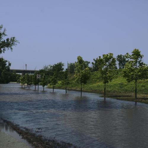
The Challenge: Northwest Grand Island and the surrounding Hall County region have faced severe flooding for decades. Significant flooding has occurred in this part of Grand Island in 1947, 1949, 1967, 1971, and 2005. One particularly damaging storm event in June 1967 inundated 42 square miles of cropland and damaged 1,162 residences and 46 businesses. In a 2000 study, it was estimated that a 100-year flood would cause an estimated $59 million in damages to urban property. Approximately 1,500 residences and 55 businesses are in danger from severe flooding. These areas are subject to periodic flooding caused by overflow of Prairie Creek, Silver Creek, and Moores Creek. The Central Platte Natural Resources District (CPNRD) wanted a long-term solution.
The Solution: The CPNRD hired our Water Resources team to provide flood-risk reduction and resilience to the northwest area of Grand Island. Our Water Resources engineers designed and oversaw the construction of four dry dams, one levee, and a 5000-acre feet detention cell. These mitigation efforts greatly reduced the area’s floodplain and flood risk. The total cost of the project was $29 million.
Project Benefits: The team provided flood risk reduction for the 100-year storm to 2,750 urban residential and commercial properties in western and northern Grand Island and prevented $130 million in future damages. The project also reduces the FEMA floodplain map in Moores Creek and remove approximately 1,500 homes and business from floodplain after the Letter of Map Revision (LOMR) is approved by FEMA. After the devastating 2019 flood event, the flood risk reduction projects in Grand Island are working as intended. Lyndon Vogt, Central Platte NRD General Manager, said “Based on the flows that we’re seeing, Grand Island is seeing more benefits from the projects than anticipated.”