JEO’s Work on K-96 Earns National Recognition
Location
Wichita, Kansas
Services
- Surveying & Geospatial
Share Project
On May 20, 2025, JEO proudly accepted a National Recognition Award from the American Council of Engineering Companies (ACEC) at the Engineering Excellence Awards Gala in Washington, D.C. This prestigious honor recognized our critical role on the K-96 Corridor Expansion Project, an ambitious effort to alleviate traffic congestion in the rapidly expanding region of northeast Wichita, Kansas.
As Wichita continues to grow, so does the strain on its transportation network. In response, the City of Wichita, Kansas Department of Transportation (KDOT), and engineering consultant WSP launched a major initiative to expand K-96 from a four-lane divided highway into a six-lane corridor, including multiple major interchange improvements. JEO was entrusted with delivering all surveying services across the entire 8.5-mile project — the largest topographic survey in our company’s history.
Precision Under Pressure
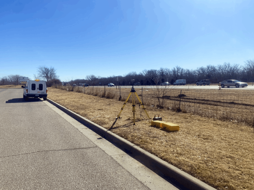
Two major challenges shaped our team’s approach: keeping crews safe amidst heavy traffic and delivering comprehensive data on an aggressive timeline. To meet these demands, we deployed a powerful combination of aerial, mobile, and static LiDAR technologies, complemented by conventional surveying in areas obscured by vegetation or structures. We’d like to recognize our partner, Technical Applications & Consulting, for their outstanding work on the aerial LiDAR and imagery for this project — their expertise played a crucial role in helping us meet the project’s tight timeline and high standards.
“We used about every technique we knew we could use,” said Shawn Graves, Survey Project Manager.
The team paired LiDAR with traditional methods to create a seamless, multi-layered dataset that balanced speed, safety, and precision. This innovative methodology enabled us to collect LiDAR data for the entire corridor in less than three days without requiring a single lane closure and with virtually no disruption to the public. Field crews were sent out only where technology couldn’t reach, dramatically reducing exposure to roadside hazards and increasing efficiency.
Groundbreaking Coordination and Deliverables
Our role extended far beyond data collection. The team established control points, recovered and monumented section corners, surveyed alignments, and delivered detailed topographic maps to support preliminary design. We also coordinated extensively with landowners and maintained continuous communication with both WSP and KDOT throughout the six-month effort.
One of the most complex aspects was utility location. With a dense network of underground utilities — particularly at key interchanges — we partnered with a local utility exploration firm to pothole in critical areas. This ensured accurate data where design conflicts were most likely. These findings were then integrated into a consolidated utility map to support planning and prevent costly surprises during construction.
As survey work concluded, we synthesized all collected data and historical highway documentation to produce a highly detailed right-of-way map, helping the design team and KDOT proactively identify areas where property acquisition might be necessary.
According to John Sommers, Survey Project Manager, “We delivered what they needed, when they needed it, and the way they wanted it.”
Setting a New Standard in Survey Technology
Our approach wasn’t just efficient — it was trailblazing. By leveraging every available surveying method, from aerial LiDAR to boots-on-the-ground, we demonstrated how technology and ingenuity can redefine corridor work.
Behind the scenes, our survey team worked across multiple states to coordinate logistics, ensure quality control, and deliver over 100 electronic files and more than 2,000 pages of documentation.
Jacob Borchers, WSP’s Project Manager, said, “JEO met the design team’s needs in providing phased deliverables to allow design to begin while the remaining survey was being acquired. The information provided was clear and accurate, giving our team the confidence needed for design.”
This award is a testament to our team’s innovation, problem-solving, and dedication to excellence. It sets a new benchmark for modern infrastructure surveying—a tech-driven, safety-first, no-compromise approach that delivers exceptional results while staying almost invisible to the public.