From Data Collection to GIS Integration: Enhancing Fremont’s Stormwater Infrastructure
Location
Fremont, Nebraska
Services
- Surveying & Geospatial
Share Project
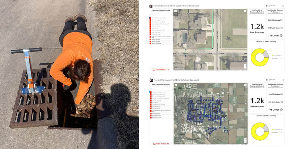
We are collaborating with the City of Fremont, Nebraska, to conduct a detailed hydraulic analysis of the city’s stormwater drainage network. While the city had various datasets covering portions of its system, it lacked a complete dataset to build a robust hydraulic model. Essential data such as pipe size, shape, material, and flow line elevations are crucial for accuracy. Similarly, storm sewer inlets require documentation, including opening size and inlet type. With approximately 4,000 storm sewer structures to assess, the scale of data collection effort was substantial.
Enter JEO’s Geospatial Services Team
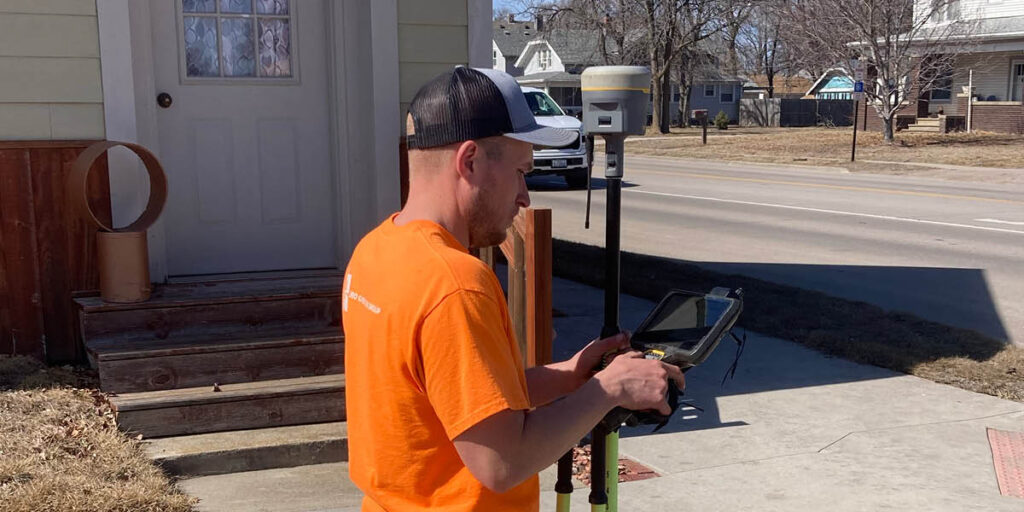
Capturing high-accuracy data was essential not only for modeling but also for supporting the city’s long-term infrastructure management needs. To meet this challenge, our Geospatial Services team, composed of GIS professionals and licensed surveyors, designed a streamlined data collection process that prioritized efficiency and data integrity.
Our systematic approach included:
– Capturing precise GPS locations.
– Recording key attributes of storm sewer structure and pipes.
– Importing data into a centralized GIS database.
The master GIS database served as a repository for all collected data, enabling seamless integration with the city’s enterprise GIS system. To standardize data collection, the team developed an intuitive digital form with dropdown menus, ensuring consistency and accuracy across all surveyed features. While some data points were essential for hydraulic modeling, others were valuable for long-term asset management. With these tools and processes in place, we then deployed multiple survey crews to systematically collect data.
Web-based Tools Facilitate Communication and Collaboration
A key advantage of the GIS database is the ability to share project data through a web-based interface. Our team developed interactive dashboards that track data collection progress, updated weekly. These dashboards have been instrumental in enhancing collaboration between field and office teams. Office staff can flag specific features for clarification, while field crews respond in real-time. If a site visit is required, a mobile app facilitates efficient communication and resolution.
An Ongoing Partnership
Although the project remains ongoing, we continue to play a crucial role in the project’s success. By combining GIS expertise with surveying precision, the team has developed a high-quality dataset that not only supports the immediate stormwater modeling effort but also lays the foundation for long-term infrastructure management for the City of Fremont.